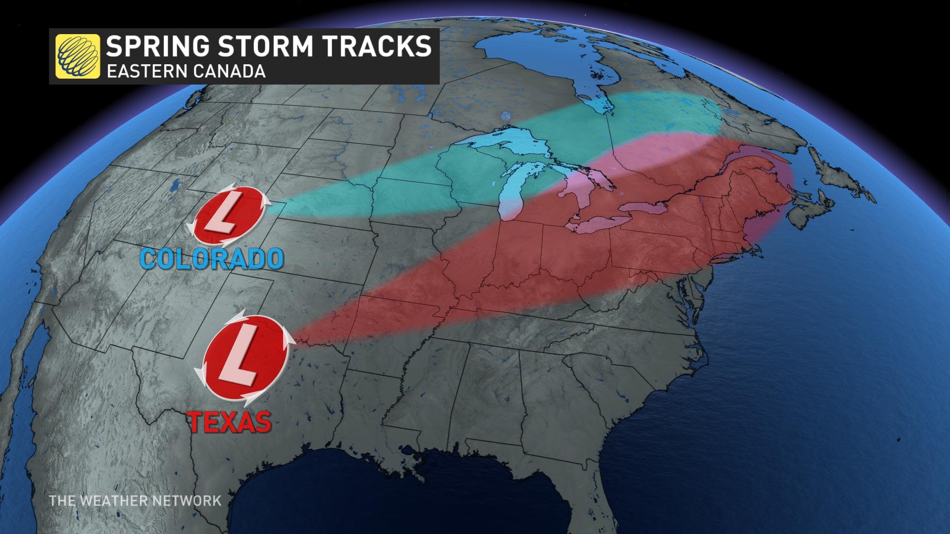
Understanding the Impact of Colorado and Texas Lows on Canadian Weather
The atmosphere is restless during the long transition from the cold depths of winter to the sultry warmth of summer. All that activity sends the jet stream into turmoil, allowing dynamic storms to spawn over the United States and sweep their active weather into Canada. Two of those storms in particular - Colorado lows and Texas lows - can have a significant impact on your everyday life.
Just about every big storm that rolls into Canada starts with the jet stream. These belts of wind roar above the cruising altitude for airliners and they can reach speeds in excess of 200 km/h.
Troughs in the jet stream, combined with speedier winds within called jet streaks, can force winds to rapidly spread out at high levels. This divergence causes air to rise from the surface to fill the void, leaving a centre of low pressure in its wake.
We often see these low-pressure systems develop on the eastern side of the Rocky Mountains when a strong trough dives over the mountain range.
The strength and length of the trough often determines where this low-pressure centre will develop. A longer, deeper trough will allow the low to form around the Texas Panhandle, while a shorter trough will cause the low to form around Colorado.
There's not much daylight between a Colorado low and a Texas low. The major difference lies in where each low-pressure system forms, which in turn will determine where we'll see the biggest impacts in Canada.